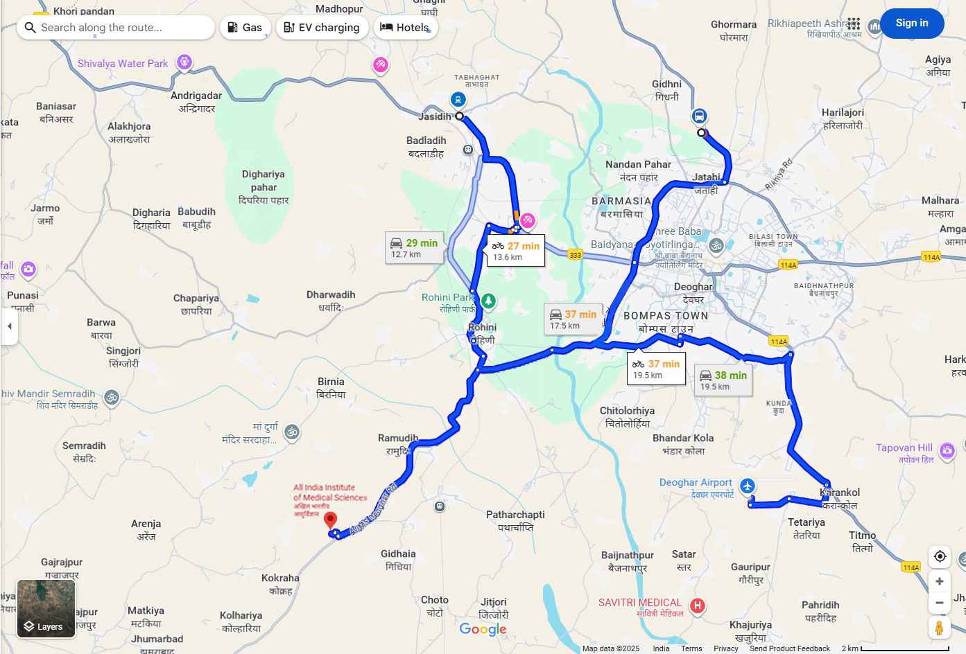
The All India Institute of Medical Sciences (AIIMS) Deoghar is accessible via multiple routes from key transit points in and around Deoghar. Below, find detailed directions and options for traveling from Jasidih, Deoghar Bus Stand, and Deoghar Airport to AIIMS Deoghar.
Distance: Approximately 13-14 km
Estimated Travel Time: Around 25-30 minutes by bike or by car
Start from Jasidih Railway Station/Bus Stop.
Head southwest on the main road passing through Badladih.
Continue towards Rohini Park, a recognizable green landmark on the way.
Follow the route through Rohini and Ramudih, leading towards AIIMS Deoghar.
The road leads directly to the AIIMS campus via the AIIMS Deoghar Road.
Jasidih is a major transit hub with good connectivity.
Plenty of auto-rickshaws, taxis, and local buses operate between Jasidih and Deoghar.
Fuel stations are available near Jasidih for travelers.
Distance: Approximately 20 km
Estimated Travel Time: Around 40-45 minutes by bike or by car
Start from the Deoghar Bus Stand in Bompas Town.
Take the road heading southeast through Deoghar city, moving past landmarks like Baidyanath Dham (major religious site nearby).
Continue along the 114A highway, passing through Chitolorhiya and Bhandar Kola.
Follow signs towards Karanikol.
From Karanikol, proceed directly to AIIMS Deoghar, located near the outskirts of the city.
The route from the bus stand passes through the heart of Deoghar, so expect some city traffic.
This is the main road used by many public and private transport services.
Taxi services and local autos are widely available at the bus stand.
Distance: Approximately 20 km
Estimated Travel Time: Around 40-45 minutes by bike or by car
Start from Deoghar Airport.
Take the airport road westward towards Karanikol.
Pass through Satar and Gauripur on the way.
Join the 114A highway near Karanikol and head towards Chitolorhiya and Bhandar Kola.
Continue to Bompas Town and follow the road to AIIMS Deoghar.
The airport is well connected by road to the city and AIIMS.
Taxi and cab services are available from the airport.
This route is ideal for visitors arriving by air and heading directly to the hospital.
Travel Modes: All routes are accessible by car, bike, taxi, and public transportation.
Travel Time Variations: Times may vary depending on traffic and road conditions.
Nearby Facilities:
Fuel stations near Jasidih and Deoghar city.
Several hotels, restaurants, and medical stores are available in Deoghar city for convenience.
Public Transport: Buses and shared autos operate regularly on all these routes.
| Starting Point | Distance to AIIMS (km) | Estimated Travel Time (Bike) | Estimated Travel Time (Car) | Key Landmarks |
|---|---|---|---|---|
| Jasidih Railway/Bus | 13-14 km | 25-30 minutes | 25-30 minutes | Badladih, Rohini Park, Ramudih |
| Deoghar Bus Stand | 20 km | 40-45 minutes | 40-45 minutes | Bompas Town, Chitolorhiya, Karanikol |
| Deoghar Airport | 20 km | 40-45 minutes | 40-45 minutes | Airport Road, Karanikol, Satar |